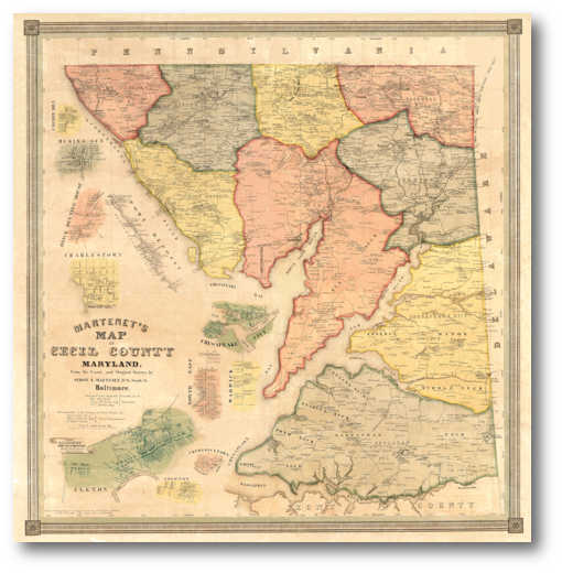
Martenet's 1858 Map of Cecil County
Simon J. Martenet
Reduced Size: 28.2" x 29.2"About this Map
Martenet's first county mapping effort, Cecil County, was published in 1858. It features shaded election districts and insets of the towns of Cherry Hill, Rising Sun, Brick Meeting House, Port Deposit, Charlestown, Chesapeake City, North East, Warwick, Elkton, Fredericktown and Cecilton. We offer it in two versions, full scale and at 2/3 scale.
 |
(Click to enlarge) |
Click on the sample image to get a close up view of this map's detail.
This page concerns the map at 2/3 scale. Click on the link below to view the page for full scale:
Original size: (41.8" x 43.2") $150.00Contact us:
14 West Franklin StreetBaltimore, Maryland 21201
Phone: 410-539-4263
press@martenet.com