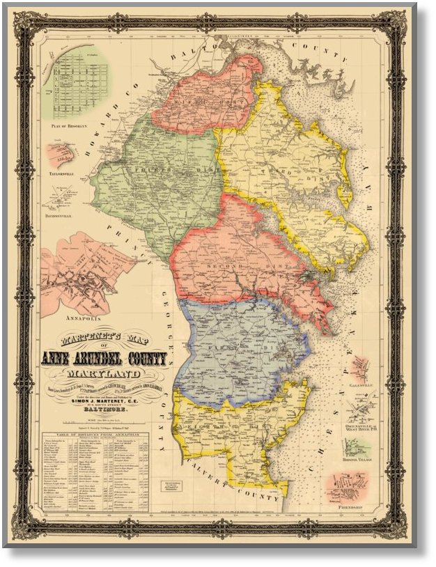
Martenet's 1860 Map of Anne Arundel County
Simon J. Martenet
Full Size: 37" x 28"About this Map
We offer our 1860 Anne Arundel County map, as it was originally offered: in two versions. The first has the election districts and notable towns colored, and the second does not. Most decorative uses would demand the colored version, we think. (The cost is the same.) Both versions feature insets of Brooklyn, Taylorsville, Davidsonville, Annapolis, Galesville, Owensville (West River), Bristol Village and Friendship.
 |
(Click to enlarge) |
Click on the sample image to get a close up view of this map's detail.
This page concerns the map at full scale. Click on the link below to view the page for 2/3 scale:
(2/3) scale: (24.5" x 18.7") $95.00Contact us:
14 West Franklin StreetBaltimore, Maryland 21201
Phone: 410-539-4263
press@martenet.com