Martenet's 1862 Map of Montgomery County
Simon J. Martenet
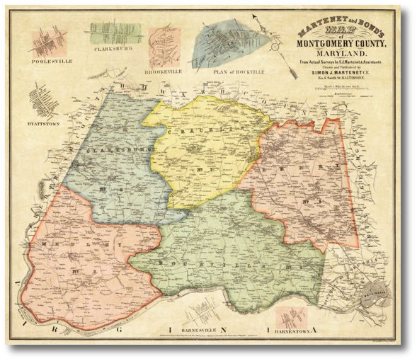
Reduced Size: 20.8" x 24.3"Our 1865 Montgomery County map features five colored election districts and insets of Poolesville, Hyattstown, Clarksburg, Brookeville, Rockville, Barnesville and Darnstown. It makes a handsome addition to any decor.
 |
(Click to enlarge) |
Click on the sample image to get a close up view of this map's detail.
This page concerns the map at 2/3 scale. Click on the link below to view the page for full scale:
Full scale: (31.25" x 36.5") $125.00Contact us:
14 West Franklin StreetBaltimore, Maryland 21201
Phone: 410-539-4263
press@martenet.com